Vilnius parks and green spaces — the complete guide
Does Vilnius have good parks and green spaces?
Vilnius is one of Europe's greenest capitals, with around 50% of the city's municipal area covered by forest. It has two regional parks within its boundaries — Verkiai (4,800ha) and Pavilniai — plus major parks including Vingis Park, Bernardinai Garden, and Kalnų Park. Almost all are free to enter and reachable from the Old Town within 30 minutes by bike or bus.
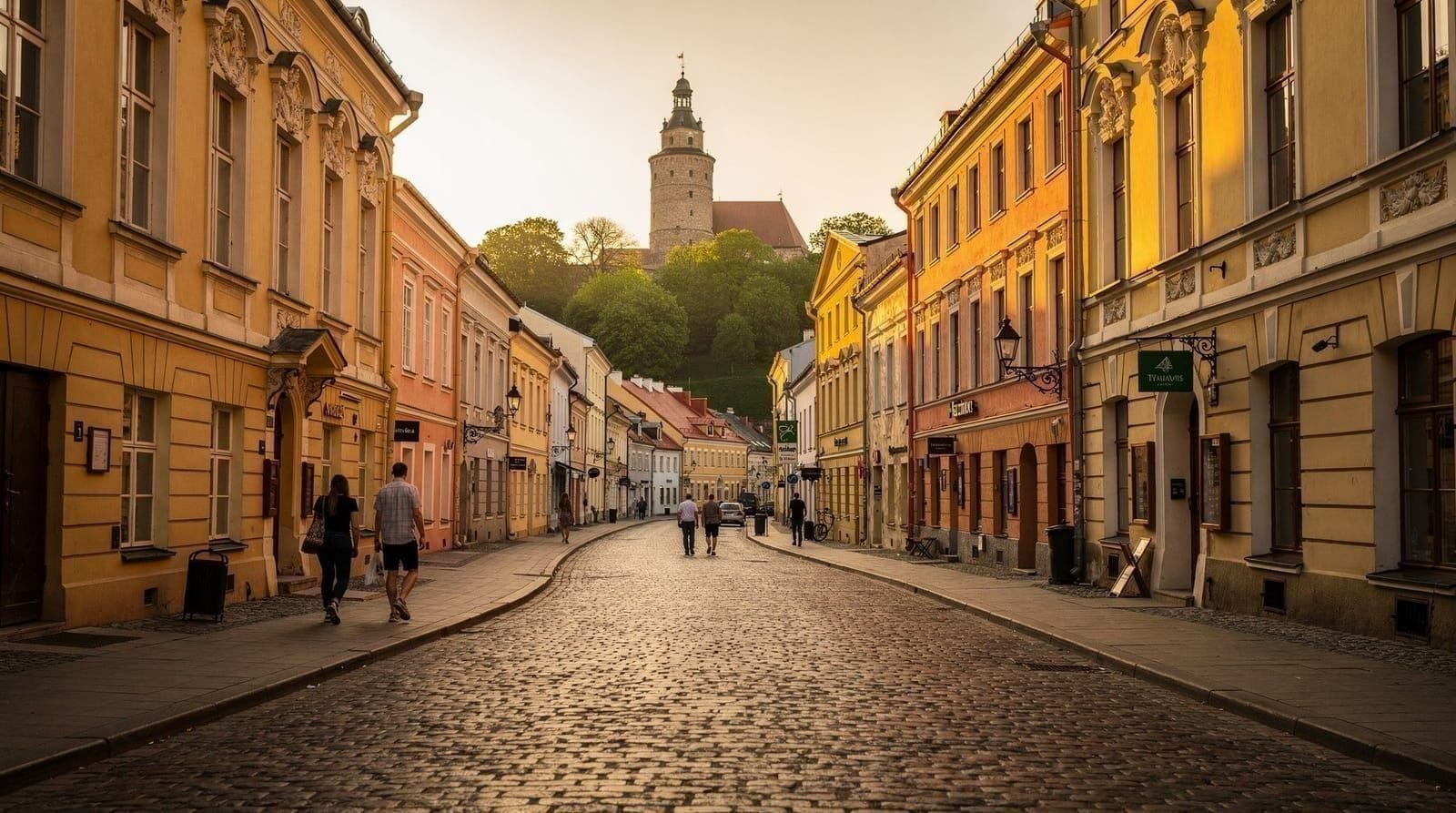
Vilnius is not a city that announces its greenness. From the Old Town cobblestones and the Baroque facades of Pilies gatvė, the impression is of a perfectly preserved historical urban core. Walk ten minutes in almost any direction and a different reality emerges: the city is threaded through with rivers, backed by dense forest, and built in a valley where the tree canopy often exceeds the roofline.
About 50% of Vilnius’s municipal area is forested or classified as green space. The city has two regional parks entirely within its boundaries and a network of parks, gardens, and riverside areas covering hundreds of hectares. This is not the manicured green of Amsterdam or Vienna — it is something rawer and more northern, where the forest often feels genuinely wild even 20 minutes from Cathedral Square.
Why Vilnius is so green
The geography is the primary explanation. Vilnius was founded in a valley where the Neris and Vilnelė rivers meet, surrounded by the Baltic Shield’s gently rolling glacial moraine terrain. The forested hills that ring the city were never agricultural land — too steep, too clay-heavy, too prone to flooding in the valleys. Medieval land use patterns left them wooded, and Soviet-era city planning, which expanded the city with apartment blocks rather than sprawling suburbs, preserved large forest blocks within the city limits.
Lithuania also has a cultural relationship with forests that goes deeper than utility. The country is over 33% forested nationally, and forests appear throughout Lithuanian mythology, folk tradition, and seasonal celebration. The idea of forest as a civic resource rather than a developable commodity is more deeply embedded here than in most European countries.
The result for visitors is a capital city where a 30-minute bike ride from the Old Town can take you into forested gorges above the Neris where you won’t see another person for an hour.
Verkiai Regional Park: the wild forest
Verkiai Regional Park is the most significant green space in Vilnius and one of the largest urban parks in the Baltic states. It covers 4,800 hectares of the Neris river valley north of the city — mostly deciduous forest (oak, elm, ash, lime, hornbeam), with meadows in the river floodplain and limestone escarpments above the river.
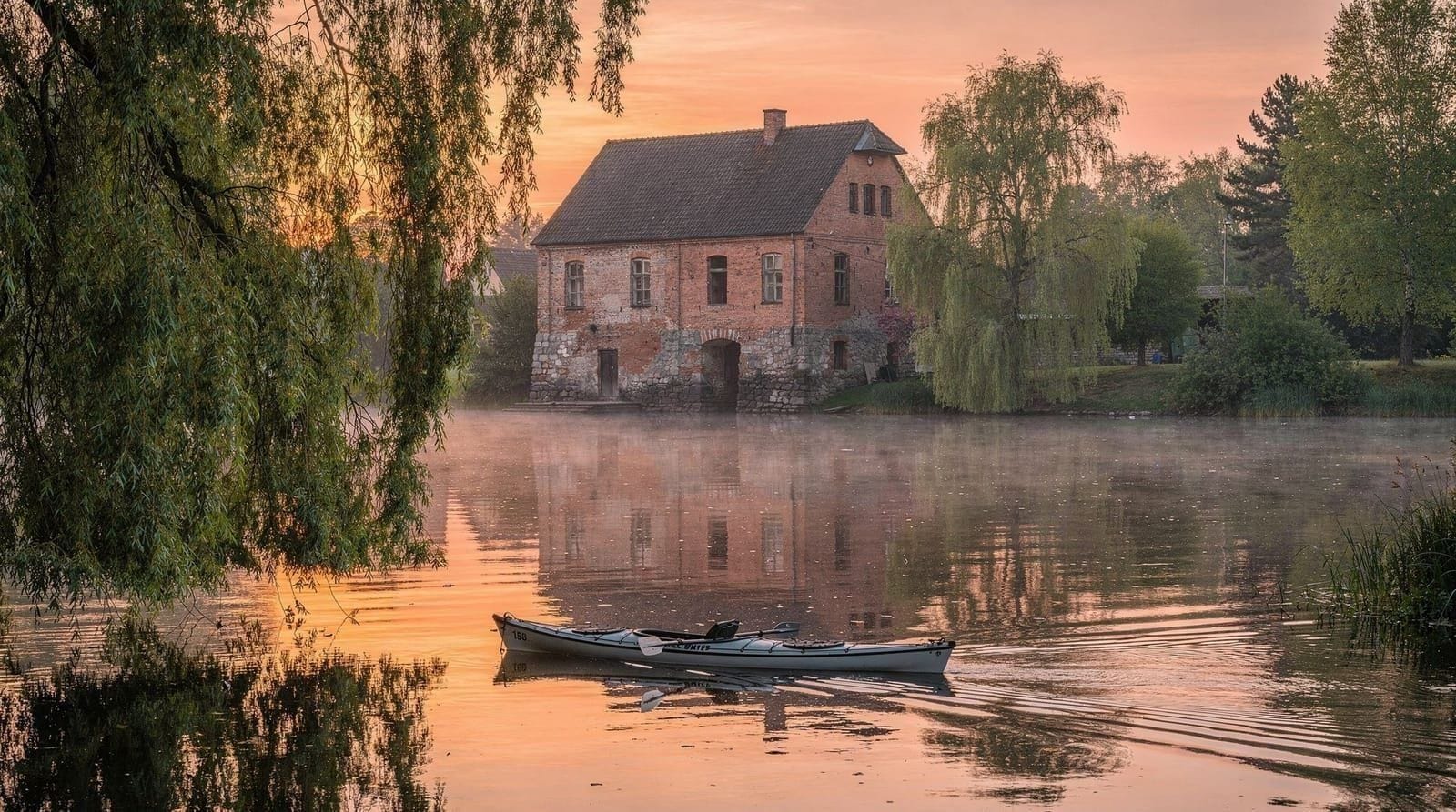
The park is named after the Verkiai estate, which belonged to the Bishops of Vilnius from the 14th century onward. The ruins of Verkiai Palace — built in the late 18th century as a summer residence by Bishop Ignacy Massalski, then destroyed in the early 19th century — stand on a headland above the Neris with views over the river valley. The main palace structure is stabilised but roofless; the service buildings and ice house survive in better condition.
What to do in Verkiai:
The park has a network of marked trails ranging from 3km to 15km. The primary viewpoint is the Verkiai headland above the palace ruins, which gives you a panorama of the Neris valley and the forested hills on both banks. On a clear day you can see the Vilnius television tower.
The Neris riverbank trails are the most beautiful sections — paths run along the water’s edge through sections of forest where the trees meet overhead. In spring (April-May), the floodplain meadows have extraordinary wildflower displays. In October, the deciduous forest turns copper and amber over the pale limestone.
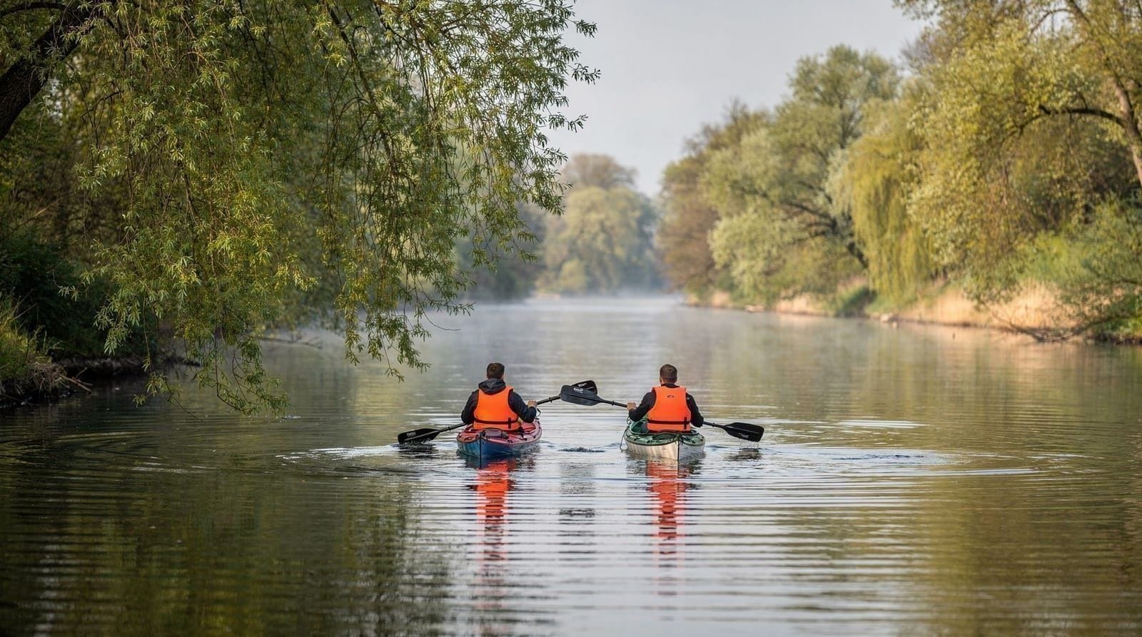
The park is also the starting point for the Verkiai sunset kayak tour, a guided 3-hour kayaking experience on the Neris through the park’s most scenic section. The combination of forested gorge, calm river, and golden evening light in June-July makes this the best single active experience in Vilnius’s green spaces.
Getting there:
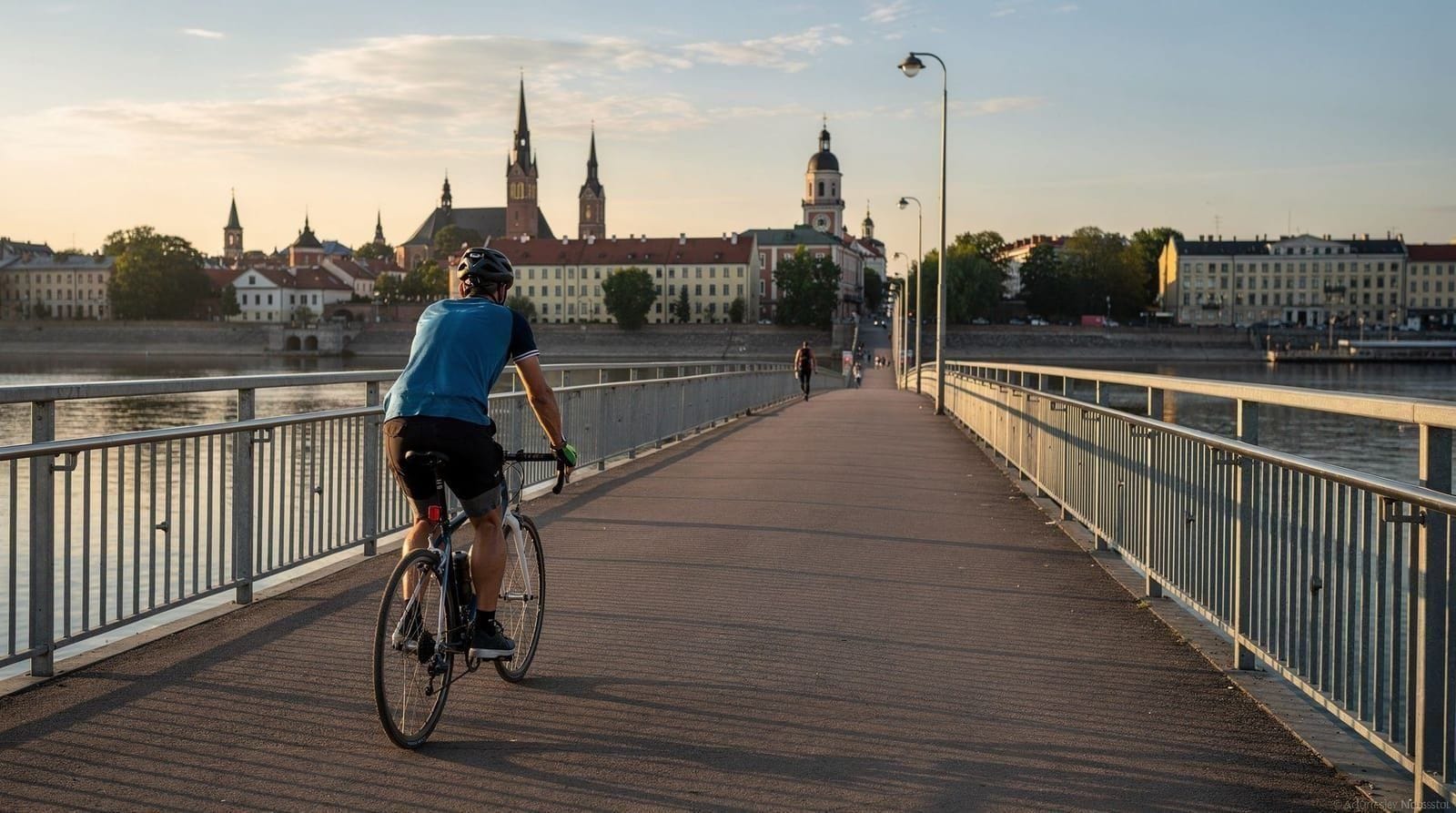
By bike: the Neris riverside cycling path runs from the city centre to Verkiai — about 10km from the Old Town, mostly flat. The cycling route is covered in detail in the cycling in and around Vilnius guide.
By bus: several routes serve the northern suburbs adjacent to the park. Bus 72 and 37 stop near the Verkiai headland.
By car: follow the Kalvarijų gatvė north from the city centre, then signs to Verkiai. Parking is available near the palace ruins.
Practical notes: All trails are free. The park has no visitor centre as such, but maps are posted at trailheads. The terrain can be muddy after rain. Bring water for longer walks.
Vingis Park: the city’s living room
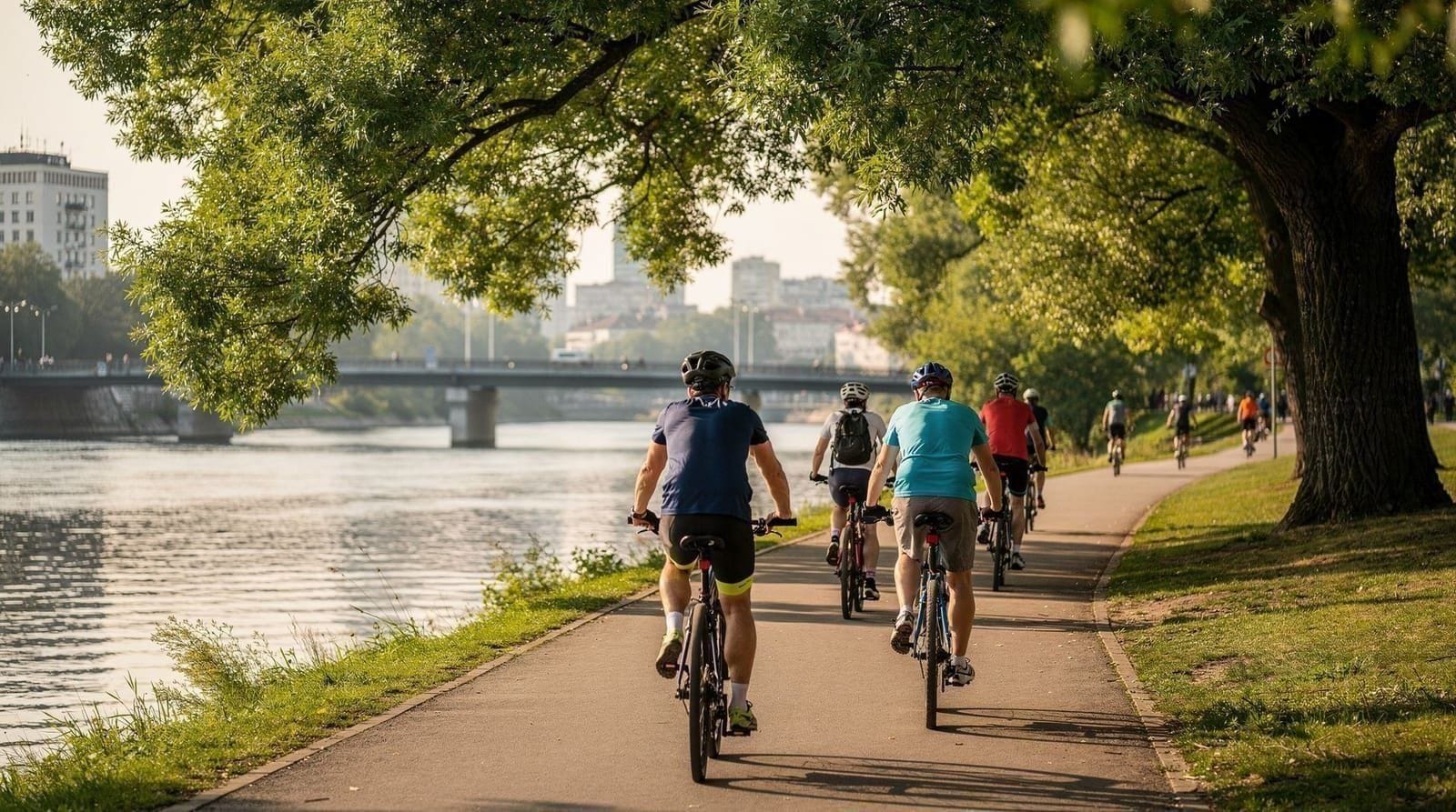
If Verkiai is the wild forest, Vingis Park is Vilnius’s public living room. It occupies a large bend in the Neris River about 2.5km west of the Old Town — a 160-hectare park with a 3km outer loop, chestnut and lime avenues, picnic meadows, and the city’s main outdoor concert venue.
The park opened in its current form in 1955, though the land has been used for public recreation since the 19th century. It sits on a peninsula formed by a loop of the Neris, which means it is almost entirely surrounded by river — you enter via one of two bridges and the water is visible from most parts of the park.
What Vingis Park is for:
Vingis is genuinely beloved by Vilnius residents as a functional park rather than a showpiece. On weekday mornings, you’ll find elderly residents doing stretching exercises in the colonnaded shelter near the main entrance. At weekends, families occupy every picnic table. The 3km outer running loop is one of the most popular in the city, with a mix of runners, walkers, cyclists, and dog owners at all times of day.
The park’s main concert venue — a large outdoor stage with an adjacent lawn that can hold tens of thousands — hosts major outdoor concerts and events throughout summer. The Song Festival (Dainų Šventė), one of the most important events in Lithuanian cultural life and listed as UNESCO Intangible Cultural Heritage, has been held at Vingis.
In autumn, the chestnut trees along the main avenues turn bright yellow and shed their nuts across the paths — small children collect them enthusiastically, a Vilnius October ritual.
Getting there: Vingis Park is a 25-30 minute walk from Cathedral Square, or 10-15 minutes by bike along the riverside path. Bus routes 1, 2, 3, 16 stop near the main park entrance on Čiurlionio gatvė.
Bernardinai Garden: the finest formal garden
Bernardinai Garden (Bernardinų sodas) is a small but beautifully maintained formal garden immediately east of the Cathedral and adjacent to the St. Anne’s and Bernardinai church complex. It occupies the land between the churches and the Vilnelė River — a wedge of civilised green in the middle of the Old Town’s most architecturally rich corner.
The garden was laid out in the 18th century by the Bernardine monks, whose church forms its southern boundary. It features formal flower beds, a duck pond, benches under old chestnut trees, a small playground, and a café that operates in summer. The atmosphere is one of quiet elegance; it’s a place where Vilnius residents bring young children, eat lunch from a nearby bakery, and read on benches.
What makes it special:
The garden is one of the few places in Vilnius where you can sit in formal garden surroundings and look directly at one of the city’s finest pieces of Gothic architecture — the late 15th-century St. Anne’s Church, whose intricate red-brick facade changes colour in different lights. Napoleon reportedly said he would like to carry it back to Paris in his palm.
For context on the church itself, the St. Anne’s and Bernardinai churches guide covers the architectural history in detail.
Getting there: Central location, 5 minutes’ walk from Cathedral Square. No entry fee. Open year-round.
Kalnų Park: hilltop walking above the Old Town
Kalnų Park (Hills Park) occupies the wooded hillside behind Gediminas Tower, rising above the Old Town to the north. It is not a park in the Vingis sense — no formal avenues, no picnic areas — but rather a stretch of forested hilltop with walking paths and dramatic views down over the Old Town roofscape.
The park is reached by walking up the steep paths behind the castle complex or via the funicular that runs to the Gediminas Tower summit (the funicular is technically for castle access but the paths at the top continue into the park). The highest point gives you a view over the Old Town that is second only to the balloon flight in its comprehensiveness — the cathedral, the church towers, the pattern of streets below.
What to do:
The main draw is the views, but the park also has several short walking loops through oak and lime forest. In spring, patches of wild spring flowers (including wood anemones and lesser celandine) appear on the south-facing slopes. The Three Crosses Monument — white concrete crosses on a hilltop visible from much of central Vilnius — is within the park and marks one of the best viewpoints.
Getting there: Enter from Kalnų parko gatvė, which runs along the back of the Old Town. The climb from street level is 15-20 minutes. Free.
Pavilniai Regional Park: limestone cliffs and wild forest
Pavilniai Regional Park is less well known to visitors than Verkiai but equally remarkable in a different way. It occupies the valley of the Vilnelė River east of the Old Town, covering about 1,600 hectares of mixed forest, river valley, and limestone terrain.
The park’s most dramatic feature is the Pūčkoriai Escarpment — a limestone cliff rising about 35 metres above the Vilnelė River, with the river running at the base and forest on the plateau above. The escarpment has an exposed, almost geological character unusual in the gentle Baltic landscape. Viewpoints at the top look down over the Vilnelė meandering through forest below.
What to do:
The Pūčkoriai escarpment viewpoint is the main destination — a 3-4km walk from the nearest bus stop or a 20-minute bike ride from the Old Town via the Vilnelė riverside path. The view from the cliff edge is one of the most dramatically unexpected in Vilnius: a sharp limestone drop, forested river valley below, the city entirely absent from the frame.
The park also has archaeological sites — the earthwork remains of several medieval hillforts are preserved within its boundaries. The Kernavė archaeological site (30km northwest of Vilnius, a UNESCO World Heritage Site) gives context for these earthwork defences if you’re interested in the broader picture.
Getting there: Bus 10G from the city centre stops at Pūčkoriai village, from which the escarpment viewpoint is about 1.5km on foot. By bike, follow the Vilnelė riverside path east from the Old Town.
Žvėrynas: the neighbourhood as green space
Žvėrynas is not a park — it’s one of Vilnius’s most attractive residential neighbourhoods, a late 19th-century quarter of wooden villas on a bend in the Neris west of the Old Town. But it functions as an extension of the city’s green space for those who know it: the streets are tree-lined, traffic is minimal on the interior roads, and the Neris bank along its northern edge has informal river beaches and boat ramps.
The neighbourhood was developed from the 1880s onward as a summer resort area for Vilnius’s middle class, who built wooden houses in a variety of decorative styles — art nouveau influences mixed with Lithuanian vernacular elements. Many of these houses survive, now permanent residences rather than summer homes, and the neighbourhood retains its distinctive wooden architecture.
What to do:
Walk the interior streets (Kęstučio gatvė, Tvirtovės alėja, Birutės gatvė) to see the wooden villa architecture. The Neris bank at the northern end of the neighbourhood has picnic spots and views across to the Vingis Park peninsula. In summer, locals use the shallow Neris here for informal swimming — the water quality in this section meets bathing standards.
Getting there: 20 minutes’ walk from Cathedral Square, or 10 minutes by bike. The Žvėrynas bridge connects to the riverside cycling path and Vingis Park.
Valakampiai: the urban beach
Valakampiai is Vilnius’s answer to the question “where do people go swimming?” It’s a recreational area on the Neris about 5km north of the Old Town, where the river forms a wide bend creating a shallow, sandy-shored lagoon — the closest thing to a proper beach within the city limits.
The area has a sandy beach (not extensive, but real sand), a designated swimming zone monitored by lifeguards in summer, beach volleyball courts, a children’s play area, and a kiosk selling ice cream and soft drinks. Water quality in the Valakampiai lagoon is tested regularly and consistently meets EU bathing water standards.
In July and August, Valakampiai is genuinely popular. Vilnius residents arrive from mid-morning on hot days. It has the easy, unpretentious atmosphere of a locals’ beach — nobody expects a private resort, and the pine trees behind the sandy strip provide shade.
Getting there: The Neris riverside cycling path connects to Valakampiai from the city centre — about 40 minutes by bike. Several bus routes serve the northern suburbs adjacent to the beach. Free.
Seasonal highlights across Vilnius’s green spaces
April-May: Cherry blossom and spring wildflowers The cherry and apple trees around Trakai (30 minutes from Vilnius) are the most famous blossom in the region, but Vilnius itself has pink blossom displays in Bernardinai Garden and Vingis Park in late April. The Pavilniai Park escarpment slopes have early spring wildflowers from late March.
June: Long evenings in the parks June’s long evenings — sunset approaching 22:00 at the summer solstice — mean that Vilnius parks are usable until nearly midnight in midsummer. Vingis Park sees evening concerts. The Verkiai sunset kayak tour uses this light to maximum effect. Street musicians appear in Bernardinai Garden.
July-August: Swimming season and full green canopy The Neris at Valakampiai is at its warmest (18-22°C). Vingis Park is at its most intensively used. The Verkiai forest is in full canopy — dense, green, cathedral-like in the oak sections.
October: Autumn colour Verkiai’s mixed deciduous forest turns copper and amber. Vingis Park’s chestnut avenues turn bright yellow. Pavilniai Park has spectacular colour over the limestone escarpment. This is arguably the most beautiful season in Vilnius’s parks, combined with cool temperatures ideal for hiking.
Using the parks as part of your Vilnius trip
The parks are not things to plan around — they’re the background fabric of a Vilnius day. Walk to Bernardinai Garden for coffee from a nearby bakery. Jog the Vingis loop before breakfast. Cycle to Verkiai as a late afternoon activity before dinner.
The 1-day Vilnius itinerary doesn’t have much room for park time, but the 2-day Vilnius itinerary builds in Vingis Park and the Neris riverside path. The weekend in Vilnius itinerary has time for Verkiai.
If you’re interested in active exploration of the parks — kayaking the Neris through Verkiai, cycling the riverside path — the kayaking near Vilnius guide and the cycling in and around Vilnius guide cover those options in detail.
For a bird’s-eye view of how all this green space fits into the city, a balloon flight is genuinely illuminating. See the hot air ballooning guide — the Old Town, Neris, and the forest belt are all visible from above.
The Vilnius city bike tour is a good way to get an oriented overview of the city’s geography before exploring the parks independently.
Frequently asked questions about Vilnius parks and green spaces
Is it safe to walk in Vilnius parks at night?
Vingis Park and Bernardinai Garden are well-lit in their main areas and safe at normal evening hours. After midnight, apply standard urban caution. Verkiai Regional Park has no lighting on its trails and is not suitable for night walking without a headtorch. The Neris riverside cycling path has lighting in some sections but is unlit through parts of the northern route.
Are dogs welcome in Vilnius parks?
Dogs are welcome in all Vilnius parks. On-lead rules apply in the formal garden areas (Bernardinai Garden) and in areas marked as dog-free. Most park areas are off-lead friendly with waste disposal stations provided. The Neris riverside path and Vingis Park outer loop are popular with dog walkers.
Is there a botanical garden in Vilnius?
Yes. Vilnius University Botanical Garden (Kairėnų Botanical Garden) is located in the northern suburbs, covering 194 hectares of plant collections, meadows, and forest. It is one of the largest botanical gardens in the Baltic states. Entry is free. Bus connection from the city centre takes 25-30 minutes.
Where can I see storks near Vilnius?
White storks nest in the villages around Vilnius, including near Trakai and along the Neris valley. Storks typically arrive in April and leave in August. Verkiai Regional Park’s meadow sections and the Pavilniai valley are the closest locations to the city where storks have been seen. The rural villages 15-20km outside Vilnius are more reliable for stork sightings — every village seems to have a nest post.
Can I have a barbecue in Vilnius parks?
Grilling is permitted in designated barbecue areas in some parks (Vingis Park has designated spots). Open fires are prohibited outside marked areas. The rules are enforced more strictly in dry summer conditions. Disposable grills from supermarkets are the standard approach for park picnics; look for the designated areas marked on the park maps at entrances.
Top experiences
Bookable activities with verified prices and instant confirmation on GetYourGuide.